Santaquin, March 9, 2021
I am so excited to explore the BST and evaluate how much has been accomplished in 30 years! Spencer and I started this 200 mile expedition at the Utah-Juab County Line. It turns out we could have started a couple miles further south, but that would have mostly been a hill climb, and this was a good place to introduce the project.
Hidden just beside I-15 in the southern end of Santaquin is a stretch of the original US-91 highway, replaced by the freeway in the early 1960s. Technically, it is a road, but the pavement is in such bad shape, it may as well be a trail. Here we worked on getting our filming legs under us. I am clearly no actor, but we wanted this intro to be completely scripted, so it took us a lot of takes to get it right. Spencer was also trying out some different creative approaches; I like what he chose in the end, except for my lame pointing.
We entered the Santaquin State Wildlife Management Area on a dirt road. This is not officially part of the Bonneville Shoreline Trail; in fact, we won’t reach the first official stretch until Springville. It was just an ordinary rather level dirt road, lots of time to do a few takes.
Eventually we shifted over to the bank of a rather large canal. I believe this was built in the 1940s to take excess water from Summit Creek over to the reservoir on the other side of the valley. It doesn’t appear to have been used for irrigation in this area, and looks like it was abandoned a long time ago. At times, there was a decent trail along one bank or the other. The north bank had great views of Utah Valley, as well as the rapidly expanding city of Santaquin.
Eventually we left the WMA, crossing into the Theodore Ahlin Park, site of Santaquin’s urban fishing pond. As these ponds go, this one is very well done, with a wide path surrounding it, and a disc golf course.
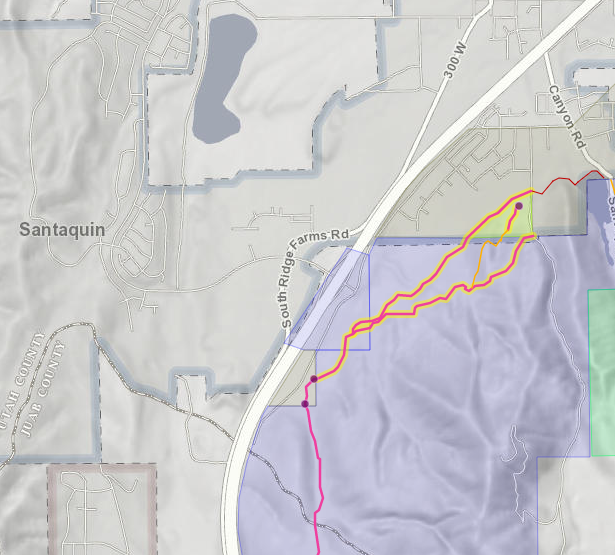
I don’t know if I will be posting my exact route every time. Although none of this trail was official BST, it was all on public land that is open to travel, so here is my route on Trailforks. Yes, our “first mile” was 2.25 miles; a fair bit of backtracking for multiple takes.